Bikoro Airport (FZBC)
Location: Bikoro, Équateur
Status: Unknown, probably never existed
ICAO Code: FZBC
IATA Code: none
Coordinates (unverified and wrong): -0.733330°, 18.133330°
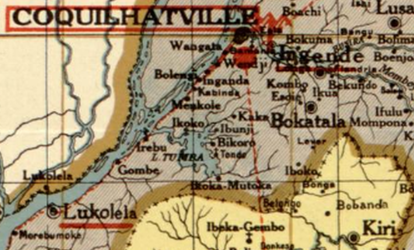
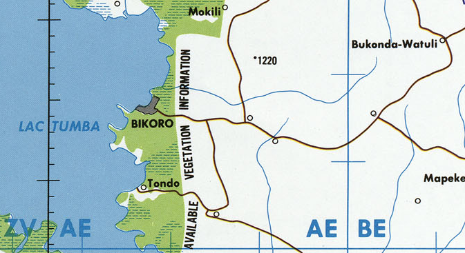
Bikoro is a market town situated on the shores of Lac Tumba, serving as the largest settlement in the region. It is connected to Mbandaka via National Road 21 (RN21) and has long been documented on various maps.
Historical Background
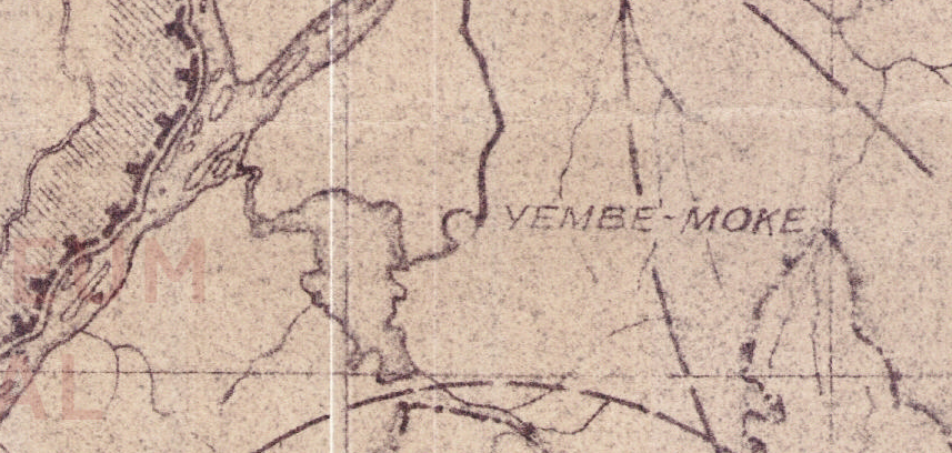
The only formal evidence of Bikoro Airport (FZBC) is its listing in the ICAO register. The coordinates provided for FZBC place it in the town center of Bikoro, but there is no historical or recent evidence that an airport ever existed at that location. Instead, Bikoro has been historically served by Yembe-Moke Airport (FZEM), which is documented in the 1947 Carte des renseignements aéronautiques and on the 1966 Joint Operations Graphics published by the U.S. Defense Mapping Agency.
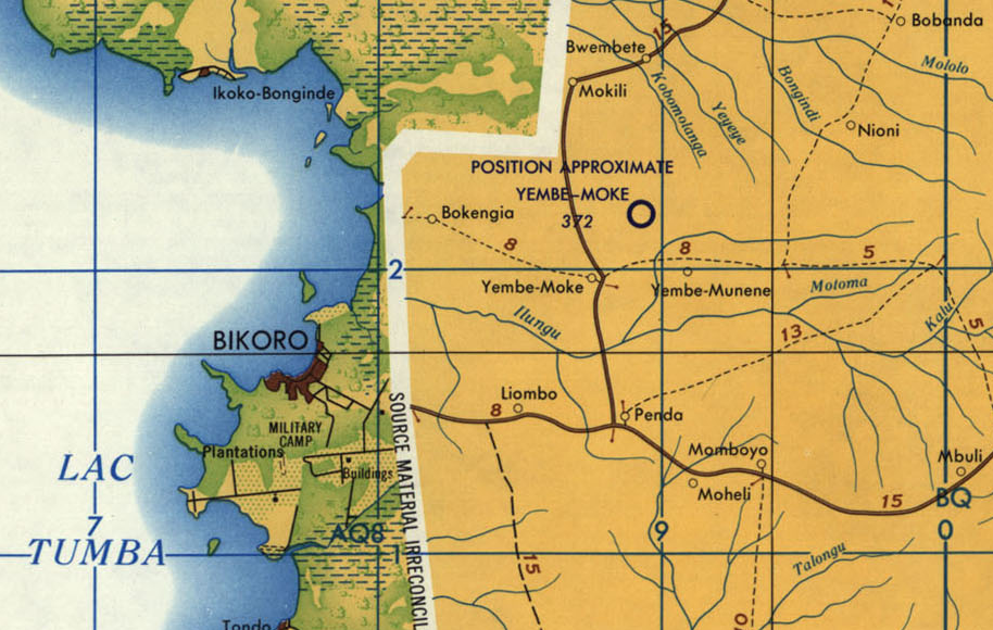
However, on the 1996 U.S. Tactical Pilotage Chart, Yembe-Moke Airport is not shown anymore.
A 2015 airport database from Mission Aviation Fellowship (MAF) explicitly states that “as of January 2012, there has never been an airstrip at Bikoro despite ONC markings and RVA info. Use Ntondo.” Ntondo Airport, a small airstrip located south of Bikoro at -0.831463°, 18.125646°, appears to be in intermittent condition, though it lacks an official ICAO designation.
Current status (as of 2025)
The status of Bikoro Airport (FZBC) remains entirely unclear, and it is likely that it never existed.
Bikoro and Bokoro – The Result of a Spelling Error?
The case of FZBC is highly unusual, as it appears in official ICAO records, yet there is no evidence of an airport at Bikoro. More curiously, the third letter of the ICAO Code, “B,” suggests it belongs to the Bandundu region, not Équateur province, where Bikoro is located. This strongly indicates that the ICAO Code FZBC was never actually intended for the town of Bikoro.
One possibility is that FZBC was originally assigned to Bokoro Airport, but due to a spelling error or misinterpretation, the name “Bokoro” was mistaken for “Bikoro.” While this may sound strange, such name inconsistencies are actually quite common in the Democratic Republic of the Congo, where multiple airports have had slight variations or outright spelling errors in the official ICAO database over the years.
What makes this theory slightly less credible however is the fact that Kempa Airport (FZBG) was located just eight kilometers from Bokoro - and it appears unusual for two official airports to exist (or have existed) so close to each other. It is possible that Kempa was originally the designated airfield for the region and that Bokoro only became relevant after Kempa was abandoned.
What remains certain is that FZBC is misplaced in the official ICAO register, but the question remains: Was it actually meant for Bokoro, or was it assigned to yet another location that has since been forgotten? If you have any additional information about Bikoro, Bokoro, or their airports, feel free to reach out!