Nkolo-Fuma Airport (FZAR)
Location: Kolo Fuma Ranch, Kongo Central
Status: Active
ICAO Code: FZAR
IATA Code: NKL
Coordinates: -5.421016°, 14.816970°
Kolo Fuma is a large cattle ranch in Kongo Central province, located between Mbanza-Ngungu and Kwilu-Ngongo. Founded in 1921, the ranch experienced steady growth throughout the colonial period, expanding significantly up until 1960, when the Congo gained independence.
Between 1970 and 1996, operations at Kolo Fuma were halted, and the ranch remained inactive for more than two decades. Today, it has regained prominence and is considered one of the larger cattle farms in sub-Saharan Africa.
Historical Background
Despite the ranch being called Kolo Fuma, the associated airfield is named Nkolo-Fuma Airport. As there is no known locality in the vicinity named Nkolo, the origin of the additional “N” in the airport’s name remains unclear.
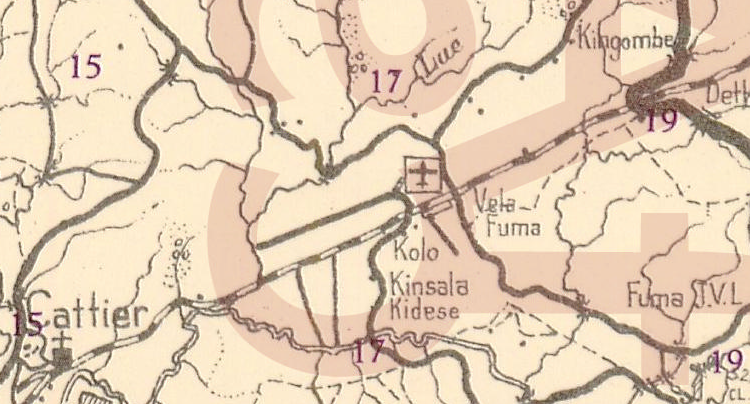
The airfield itself is quite old. The earliest known map depicting the airfield is the 1947 Carte des Renseignements Aéronautiques, which refers to it simply as “Kolo” at that time. By 1953, another map places the airfield adjacent and parallel to the railway tracks. Interestingly, the airfield’s actual location is about one kilometer south of the railway, raising the possibility of either a mapping error or a relocation at some point.
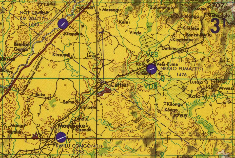
By 1967, the Joint Operations Graphics, published by the U.S. Defense Mapping Agency, listed the airfield under its current name, Nkolo-Fuma. The fact that Nkolo-Fuma Airport was also assigned an IATA Code (NKL) suggests that it was once considered a significant airfield, possibly serving logistical or agricultural purposes linked to the ranch.
Current Status (as of 2025)
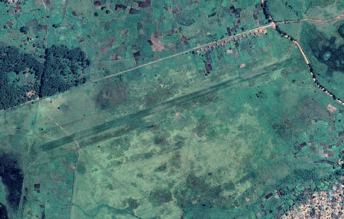
Despite its long history and the presence of an IATA Code, Nkolo-Fuma Airport is little more than a 1,150-meter grass landing strip with no visible facilities.
While the airfield is clearly visible on recent satellite imagery, it appears to see very little use. It remains unclear if and when aircraft still operate at the site.