Lukala Airport (old)
Location: Lukala, Kongo Central
Status: Redeveloped
ICAO Code: none
IATA Code: none
Coordinates: -5.515586°, 14.499001°
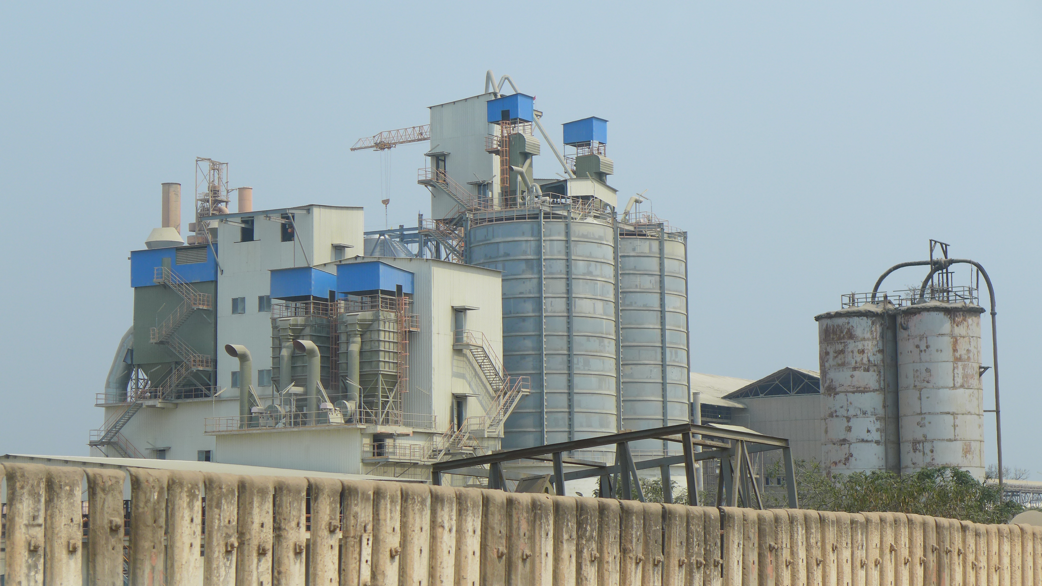
Lukala is a small industrial town in the Kongo Central Province of the Democratic Republic of the Congo (DRC), located along the RN1 highway and Matadi-Kinshasa railway. It is best known for its cement production, centered around the Cimenterie de Lukala (CILU), the country’s oldest and most significant cement plant. Established in 1921 by the Société des Ciments du Congo (CICO) under Belgian colonial rule, the factory was strategically placed near limestone deposits and a railway link to facilitate cement distribution. Initially dependent on labor-intensive vertical kilns, the plant transitioned to rotary kiln technology in 1955, supported by the Zongo hydroelectric dam, which improved energy efficiency. After Congolese independence in 1960, the cement industry remained vital, with the factory passing through various ownerships, most recently operated by HeidelbergCement Group.
The town’s infrastructure reflects its industrial heritage. Lukala’s segregated colonial layout once divided European managers and African workers, a structure that persisted into the post-colonial period. Today, the factory continues extraction and production, though challenges such as infrastructure degradation, fluctuating cement demand, and environmental concerns persist. The area surrounding the plant is marked by quarries, abandoned kilns, and company housing, remnants of its colonial past. Studies, such as Robby Fivez’s “The Rubble in the Jungle”, highlight Lukala’s role in colonial industrialization, emphasizing how its “cementscape” shaped the broader Congolese built environment. Despite economic shifts, Lukala remains a key hub for cement supply in the DRC, supporting urbanization projects across the country.
Historical Background
The earliest known depiction of an airfield in Lukala appears on the 1947 Carte des Renseignements Aéronautiques, indicating that aviation activity in the area dates back to at least the mid-20th century.
By 1953, a map published by the Institut Géographique du Congo Belge provides a detailed representation of Lukala Airport (old), showing it located just west of the town, directly adjacent to the Matadi-Kinshasa railway. The 1967 Joint Operations Graphics, published by the U.S. Defense Mapping Agency, confirms this location, referring to the airfield simply as “Lukala”.

At some point between 1966 and 1984, the airport was relocated to a new site east of the town. This new airfield, Lukala Airport (FZAP), is already visible on 1984 satellite imagery. Interestingly, the 1996 U.S. Tactical Pilotage Chart no longer depicts any airfield at Lukala.
With the new location becoming operational, the old airfield was abandoned, and over time, urban expansion gradually reclaimed the site.
Current Status (as of 2025)
Lukala Airport (old) no longer exists. Its former location has been redeveloped, now occupied by scattered houses and subsistence fields, leaving no visible trace of the original airstrip.
See Also
- Lukala CICO Airport, another, third airport that has possibly served Lukala
- List of Airports
- Homepage