Kinzolani Airport
Location: Kinzolani near Sanga, Territoire de Luozi, Kongo Central
Status: Redeveloped
ICAO Code: None
IATA Code: None
Coordinates: -5.186451°, 13.682830°
Information about the area surrounding Kinzolani Airport is scarce. Old maps confirm that the village next to the airfield only developed after Congolese independence, as neither the village nor the name Kinzolani appears in older records.
There is another village called Kinzolani near Kasangulu, also within Kongo Central province, but it is unrelated to this airfield. The nearest older settlement in the vicinity is Sanga, though this name is extremely common throughout the Congo region, making it difficult to link historical references to this particular location.
At -5.193556°, 13.696760°, some larger buildings are visible on satellite imagery, likely schools or a small health center, suggesting that Kinzolani/Sanga has some local importance beyond typical village life.
Historical Background
No records exist regarding the establishment of Kinzolani Airport. The airfield does not appear on any historical maps or aeronautical charts, further reinforcing the lack of official documentation about its construction and use.
The only known source confirming its existence is the 2015 MAF Airports Directory, which provides detailed coordinates and a runway heading of 16/34. The inclusion of specific data suggests that the airfield once saw MAF activity, though its operational history remains unclear.
Current Status (as of 2025)
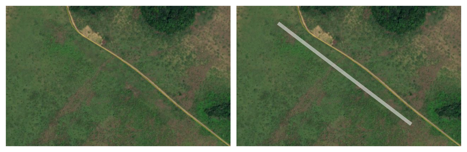
A review of high-resolution satellite imagery at the coordinates provided in the MAF database reveals no immediate visible signs of an airstrip. However, upon closer inspection across different datasets, faint remnants of a long-abandoned runway can be identified.
Interestingly, the orientation of these runway traces does not match the heading provided in the MAF list. The visible remains indicate a 13/31 heading, whereas the MAF data lists 16/34. This discrepancy is significant, making it unlikely to be caused by GPS offsets or magnetic variation alone.
Given that typos in coordinates have been observed in other MAF records, an attempt was made to adjust the coordinates slightly to check for alternative locations, but no other possible airfield sites were found.
It is most likely that the patterns observed at the provided location are indeed the remnants of Kinzolani Airport. The reason for the discrepancy in runway heading remains unknown, but the airfield may have been makeshift or rarely used.
Recent satellite imagery shows the construction of two new buildings on the former airfield, confirming that the site has been repurposed for other uses. As a result, Kinzolani Airport is classified as redeveloped.