Nsangi Airport (FZAF)
Location: Nsangi (near Ngidinga), Kongo Central
Status: Abandoned
ICAO Code: FZAF
IATA Code: None
Coordinates (unverified and incorrect): -5.600000°, 15.316670°
Nsangi is a small locality near the village of Ngidinga in Kongo Central province. While not widely known, multiple sources indicate that Nsangi was once the location to a textile factory, but not much about its history can be found.
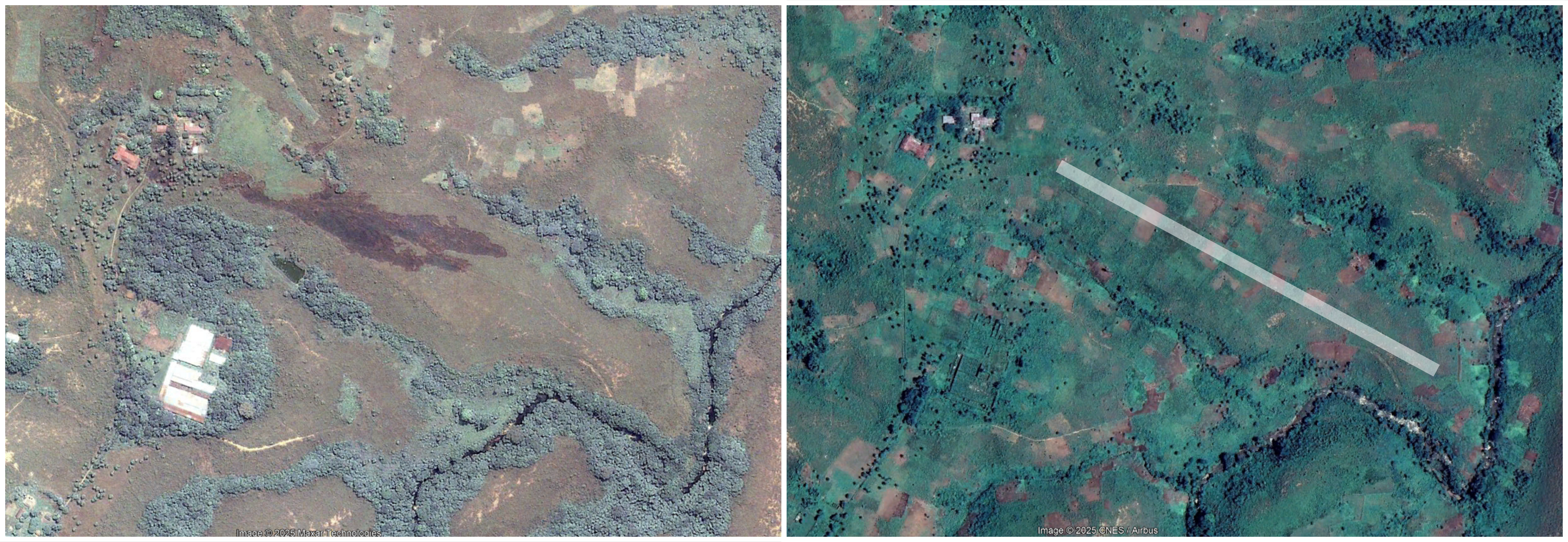
What can be assumed to be the remains of this factory can still be observed at approximately -5.605841°, 15.308807°. While the factory still had a roof in 2005, recent satellite imagery suggests that only foundation walls remain, heavily overgrown by vegetation, indicating that the site has not been used for a long time.
In 2005, the Congolese newspaper Le Potentiel published an article stating that the factory was set to reopen soon. However, based on its current deteriorated condition in 2023 satellite imagery, it appears that this reopening never materialized.
Historical Background
There is virtually no publicly available information regarding the history of Nsangi Airport (FZAF) other than its appearance in the ICAO database with the code FZAF and a set of generic, inaccurate coordinates.
The aeronautical Joint Operations Graphics maps published by the U.S. Defense Mapping Agency are usually a key resource for confirming the existence of such airfields. However, the specific map sheet covering Nsangi does not seem to be available online, making it difficult to verify whether the airport was ever officially documented.
Additionally, the 1996 U.S. Tactical Pilotage Chart, which still included many smaller and abandoned airstrips, does not feature FZAF, suggesting that the airport was either already defunct by then or never widely recognized.
Current Status (as of 2025)
Given the lack of documentation, Nsangi Airport (FZAF) was likely constructed as a private airstrip to serve the textile factory. However, its exact location remains uncertain.
Despite extensive analysis of satellite imagery, no trace of a former runway has been found. The given coordinates (-5.600000°, 15.316670°) are likely incorrect, as they do not correspond to any visible airstrip or cleared area.
However, at -5.604005°, 15.313070°, just east of the factory ruins, there is a long, flat section of terrain that appears to be the only suitable location for a runway in the area. This section of terrain alings with a heading of 120 degrees - corresponding to the runway designation 12/30 found in the 2015 UN DR Congo Aerodromes and Helipads Directory. While it remains purely speculative, this location could have once served as the Nsangi airstrip.