Konde Airport (FZAU)
Location: Konde, Kongo Central
Status: Abandoned with no visible traces left, exact location unknown
ICAO Code: FZAU
IATA Code: none
Coordinates (not verified): Near -5.756851°, 12.264788°
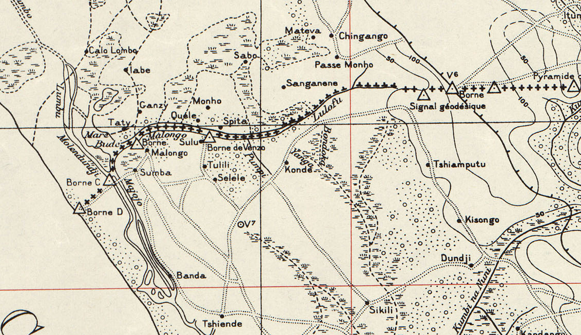
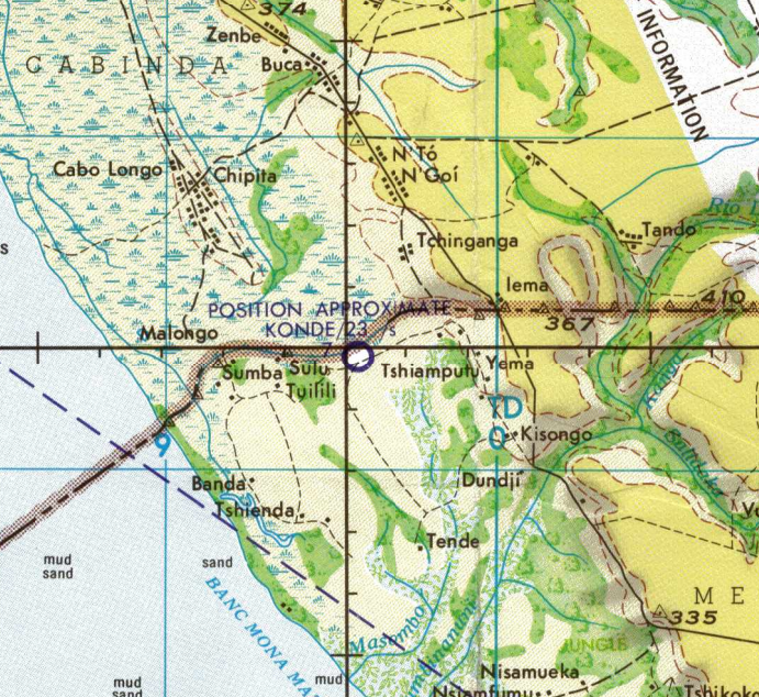
Konde is a small village situated at the westernmost point of the Democratic Republic of the Congo. It is located approximately 1.5 kilometers south of the border with the Republic of Congo. While various old maps confirm the village’s existence, little is known about Konde itself. Satellite imagery reveals a small settlement with around 100 small houses or huts, with no visible signs of greater economic activity that would justify the presence of an airport.
Historical Background
Konde Airport has an assigned ICAO code (FZAU) and is included in official aviation databases. However, very little documentation is available regarding its origins or operational history.
The 1967 version of the aeronautical Joint Operations Graphics published by the U.S. Defense Mapping Agency confirms the existence of an airport near Konde, mapping it in the general vicinity of -5.756851°, 12.264788°. However, the same map explicitly notes that the given position of the airport is only approximate, suggesting that even in 1967, Konde Airport was of limited significance and that its exact location was not well documented.
In the 1996 U.S. Tactical Pilotage Chart, the airport is not included anymore.
Current Status (as of 2025)
Despite extensive analysis of satellite imagery, no clear trace of Konde Airport could be identified. Some linear patterns are visible in the nearby fields, but they appear to be related to agriculture or drainage systems rather than remnants of a former airstrip. Additionally, they do not correspond to the 03/21 runway heading provided in both the 2015 MAF Airports Directory and the 2015 UN DR Congo Aerodromes and Helipads Directory. Interestingly, two roads extending southwest from Konde village do align with the given runway heading. However, both appear to have historically been roads rather than repurposed airstrips. While it is not uncommon in the Congo for roads to double as airstrips (and vice versa), no evidence suggests that this was the case in Konde. It remains unclear why Konde Airport was established, and it is likely that it has been abandoned many decades ago, leaving no trace of it.