Inkisi Airport (FZAS)
Location: Kisantu, Kongo Central
Status: Abandoned
ICAO Code: FZAS
IATA Code: none
Coordinates (verified): -5.162924°, 15.003078°
Kisantu is a historical town in Kongo Central province, located along the Matadi-Kinshasa railway and National Road 1 (RN1). The name “Inkisi” originates from the Inkisi River, which crosses the railway at Kisantu. Over time, the river’s name began to be used synonymously with the town, leading to maps labeling the settlement as either “Inkisi” or “Kisantu,” and sometimes marking both names separately.
Kisantu has grown into a regional center with over 75,000 inhabitants and is home to a cathedral and a renowned botanical garden. The town benefits from exceptional accessibility by Congolese standards due to its paved road connection between Kinshasa and Matadi, as well as its railway station, though train services remain infrequent.
Historical Background
No official documents regarding the establishment of Inkisi Airport have been found. The airport only appears in official databases under the ICAO code FZAS, without further details. It is notable that the airport is referred to as “Inkisi” - a name historically associated with the river rather than the town itself. The provided ICAO coordinates (-5.167, 15.000) are very generic and appear incorrect, as they point to a location directly on National Road 1.
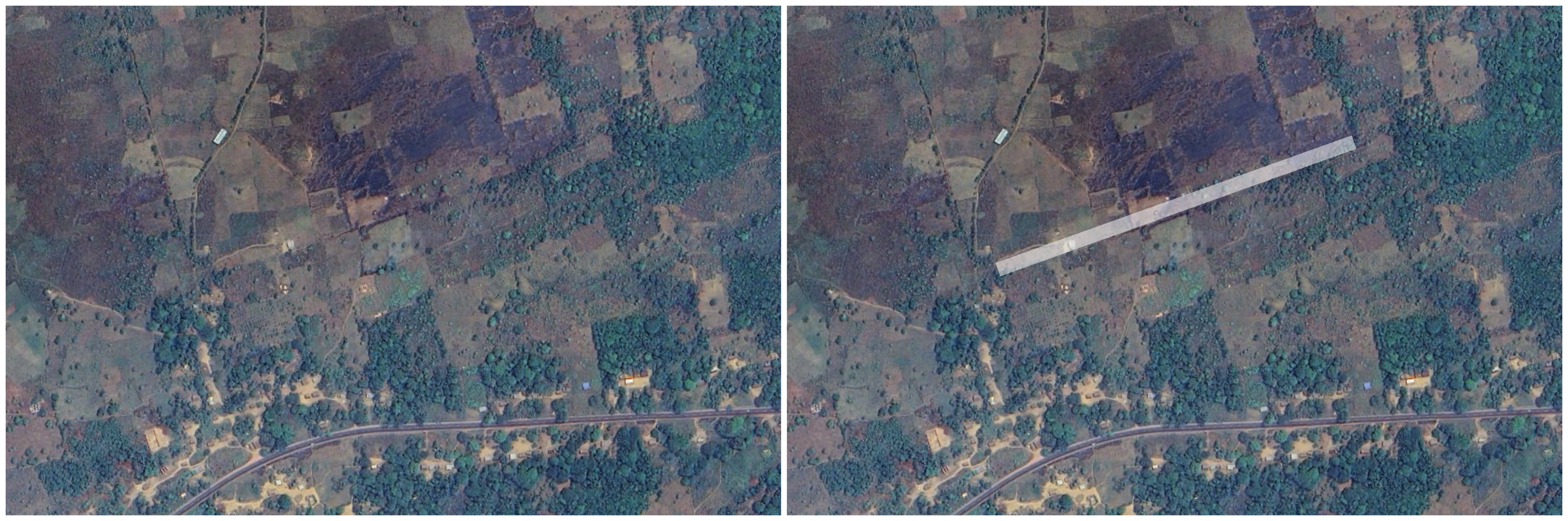
An analysis of old maps reveals the existence of an airport 535 meters northeast of the given coordinates. However, both a 1953 map published by the Institut Géographique du Congo Belge and the 1967 aeronautical Joint Operations Graphics by the U.S. Defense Mapping Agency refer to this airport as “KM 237 Airport.” This name originates from the airport’s position at kilometer 237 along National Road 1. Since no historical map indicates the presence of another airport in the vicinity, it is likely that KM 237 Airport was later renamed Inkisi Airport. However, final confirmation from a local source is still needed.


Current Status (as of 2025)
Today, barely any trace of Inkisi Airport (FZAS) remains. Its location was identified solely thanks to the 1953 IGCB map, which provided crucial confirmation. Recent satellite imagery does reveal subtle patterns in vegetation and agricultural use that could indicate a former runway, but without the historical map, this would have been impossible to verify. Inkisi Airport appears to have been abandoned decades ago, most likely due to the decent road connection between Kisantu and Kinshasa, which reduced the need for air travel in the area.